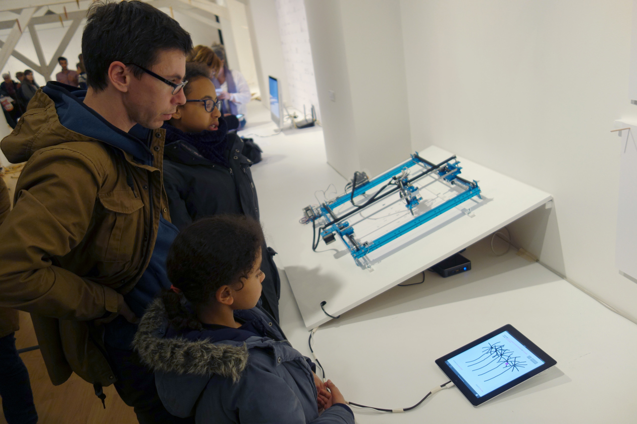
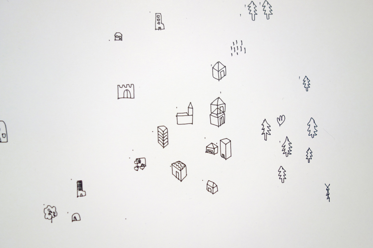
Wip Map plotter
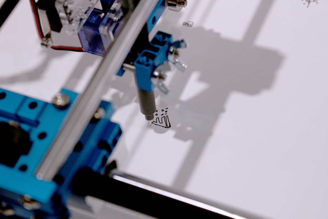
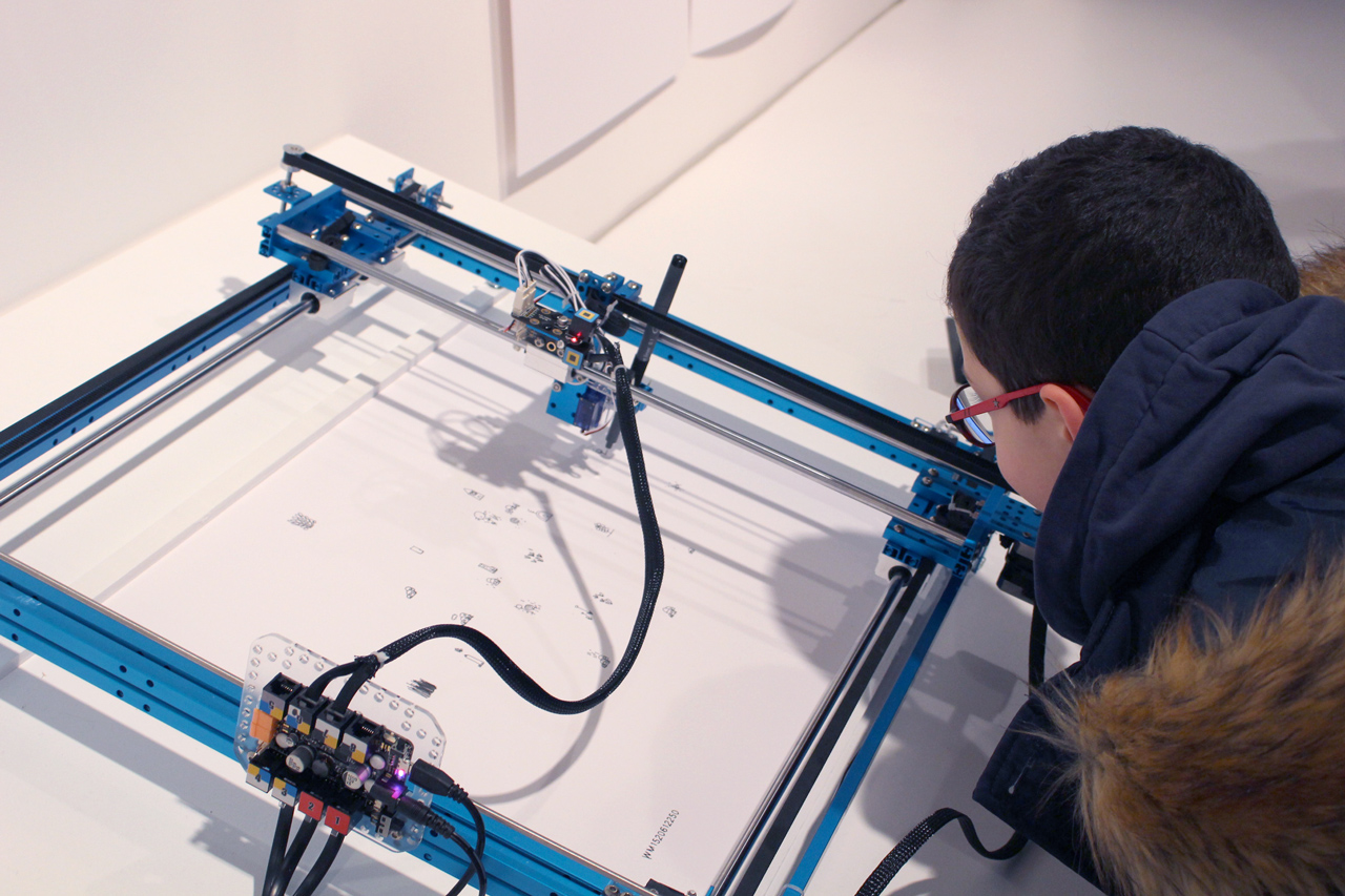
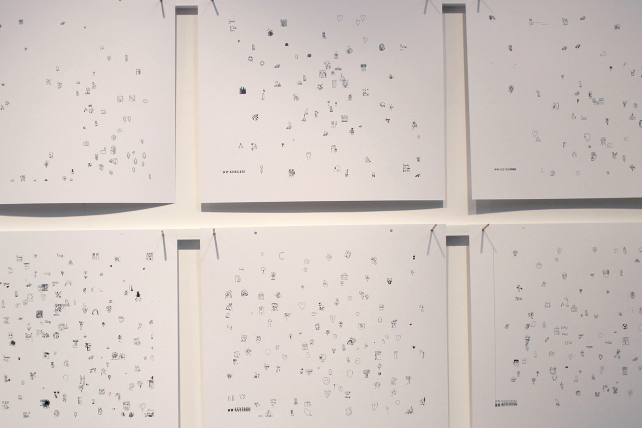
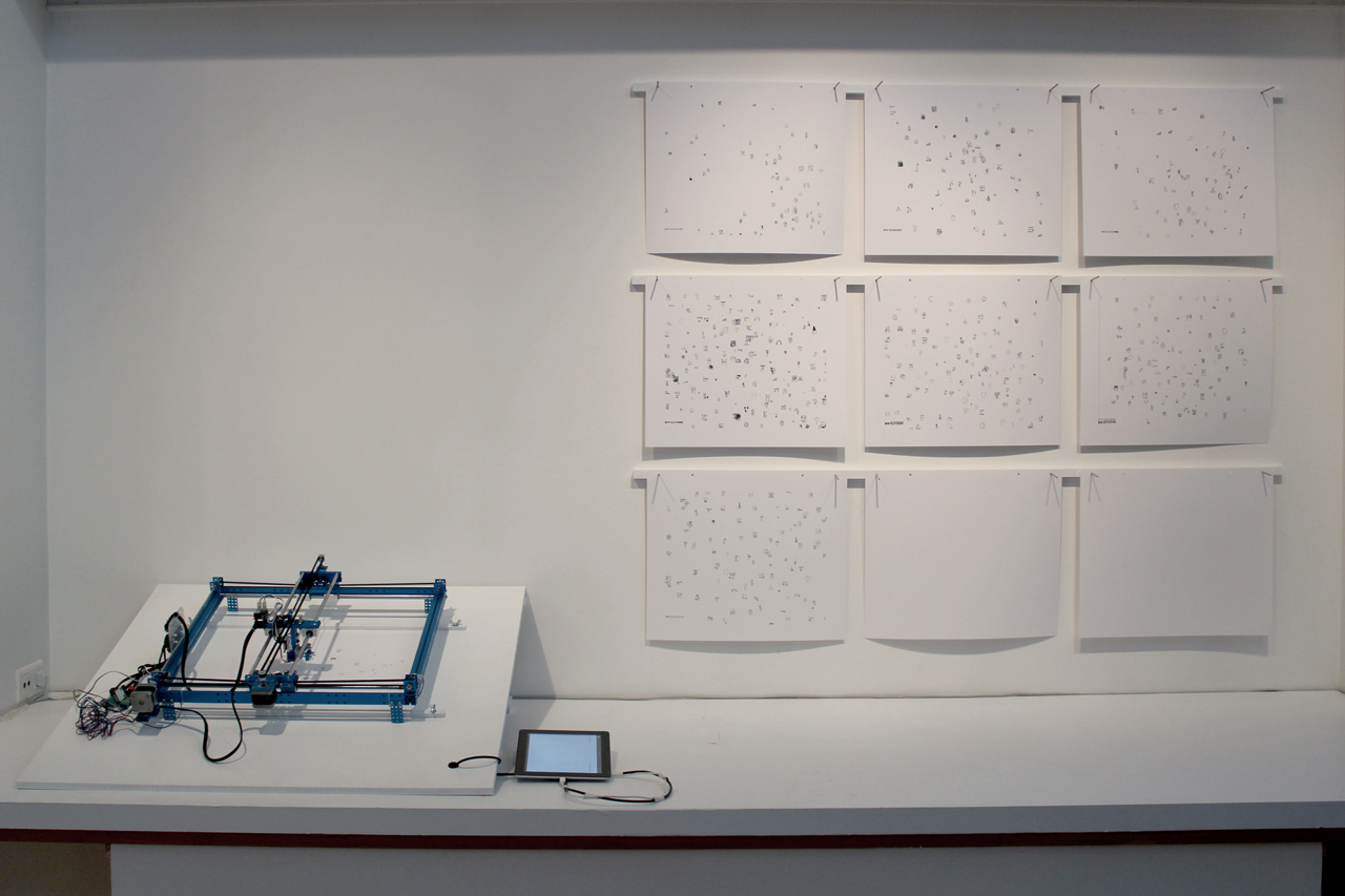
Users create an interactive and collective map through a connected drawing interface. The houses, the valleys, the roads of each one gradually generate a landscape which is drawned by a plotter.
Wip Map creates links between the field of cartographic design and current technologies coming from Fablabs and the web. The physical installation consists of 2 elements: – A sheet of paper on which a plotter (plotter opposite right) will come to wander and draw. – An interface (type Ipad) from which the participant will be able to answer a series of questions not by words but by drawing. It is these drawn response fragments that will compose the map.
Credits
- Creation: Chevalvert, 2018
- Contributors: Stéphane Buellet, Pricilla Degardin, Arnaud Juracek, Mathieu Mohamad, Patrick Paleta, Julia Puyo Calvo